Hohe Kelch/Belchen picnic routes

posted in: * | 0

Awesome that you are checking the routes! I am so excited for the picnic and to see what the day brings :). You should not worry, even though Hohe Kelch seems to be remote and hard to reach, there are plenty of option from very easy 20min hike to longer adventures. For sure, there is something for everyone!

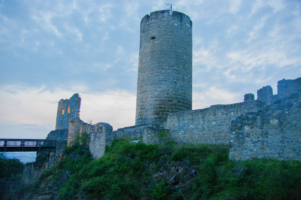
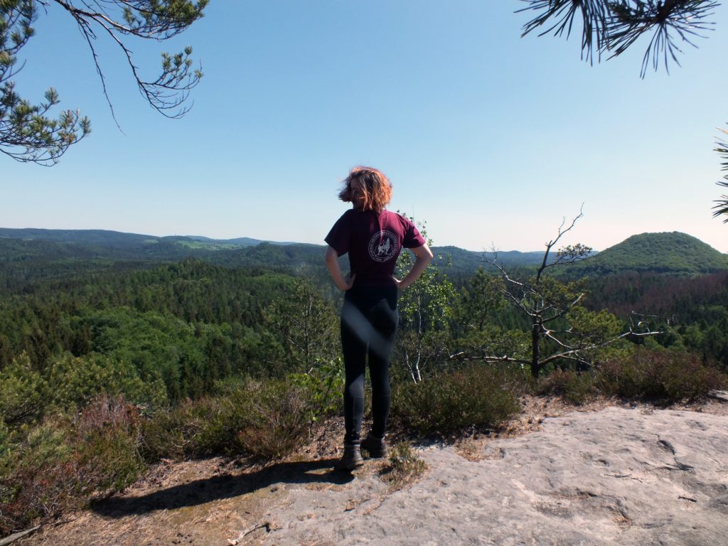
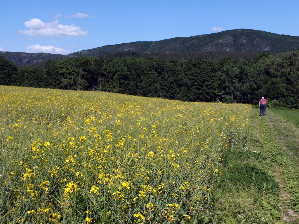
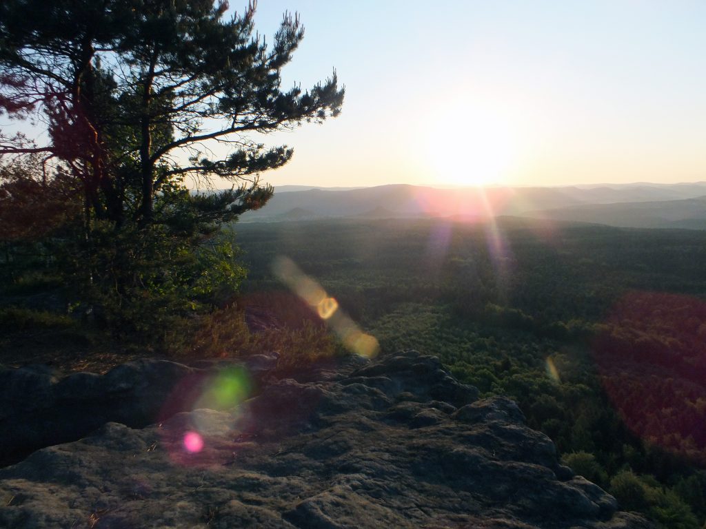
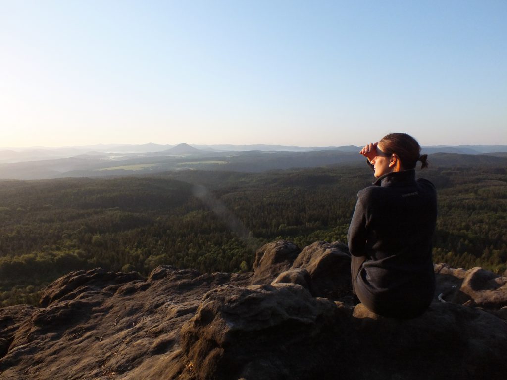
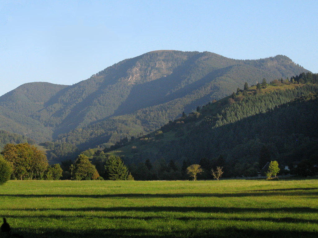
Hohe Kelch is a lovely destination for reaching up Belchen. Its beautiful and inviting meadow has offered us a snack break for so many times, as well as the panoramic view of south Schwarzwald and Eastern wall of Belchen itself. Sometimes Alps are visible as well, from Zugspitze to Mont Blanc! I could not think of a more ideal place to enter thirties :). If you have been to Hohe Kelch before, for sure you know what I am talking about. If not, I am beyond thrilled to show you around! I invite you to explore a small description of routes I think might be interesting to take. Most of them I hiked myself at least once, so enjoy and I am excited to see you up there!

Coming by public transport:

There are several decent options how to reach Hohe Kelch/Belchen by public transport, varying from very easy to more challenging routes. Public transport offers flexibility with choosing two different routes for ascent and decent to Hohe Kelch and could be a nice opportunity to have a longer hike in this beautiful area. Use this resource as an inspiration :).

Belchen Talstation – Hohe Kelch (very easy to easy)

You can reach Belchen Talstation by bus from Bad Krotzingen/Münstertal (291 Bad Krotzingen/Münstertal – Belchenbahn, take until Belchenbahn OR Wiedener Eck (not all busses go through to Belchen), then take 7306), from Titisee (7300 Titisee, Bahnhof – Zell (Wiesental), Bahnhof, change at Aitern, Abzweigung to 7306 direction Wieden (Schw), Wiedenrütte and drive until Aitern, Multen), from Kirchzarten (7215 Kirchzarten, Bahnhof – Todtnau, Busbahnhof, change at Todtnau Busbahnhof to 7300 direction Zell (Wiesental), Bahnhof, change at Aitern, Abzweigung to 7306 direction Wieden (Schw), Wiedenrütte and drive until Aitern, Multen), from Basel (S6 to Zell, bus 7300 Zell, Bahnhof – Todtnau, Busbahnhof, change at Wiese to 7306 direction Aitern, Belchenbahn Talstation and drive until Aitern, Multen).

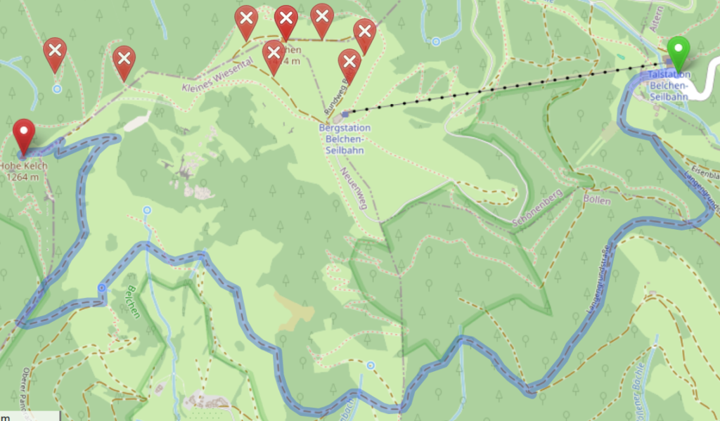
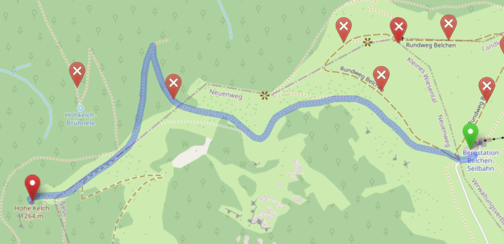
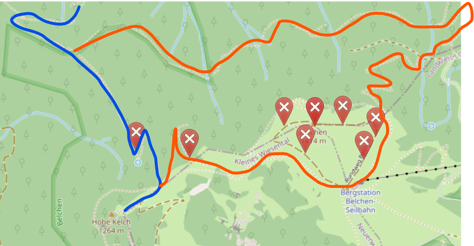
From Belchen Talstation you can choose to walk 3,8-5,4km or take a cable car to Belchenhaus and then walk. Please have a look at the 3 suggested routes and choose the most fitting for your hiking mood. There are many alternative routes and shortcuts, do not be shy to explore the map and optimize the route for your own taste! Here I used www.openstreetmap.org route generator, however, it is not always the best answer :).

Route 1: easy + very scenic 3,8km 40-60min hike through Belchenhaus itself. From there Hohe Kelch is a short very scenic walk away. On a clear day you can even see Alps from there!

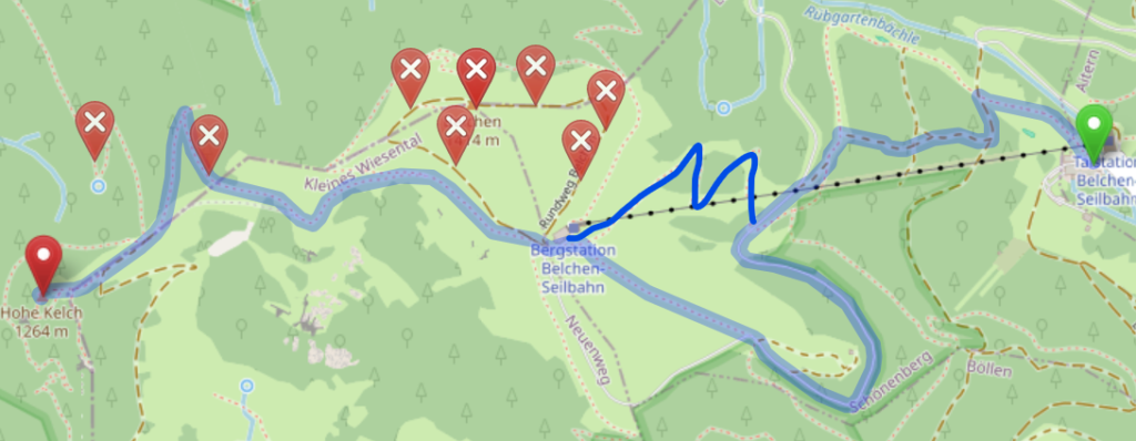
Route 2: easy + scenic 5,4km 1,4-2h hike without reaching Belchen top, trailing at its southern face with a scenic view to Schwarzwald. Total high ascent ~450m.

Route 3: very easy + very scenic 1,5km 10-20min walk in case you wish to take the cable car. From the Belchen it is a very short walk down the hill until the Hoche Kelch.

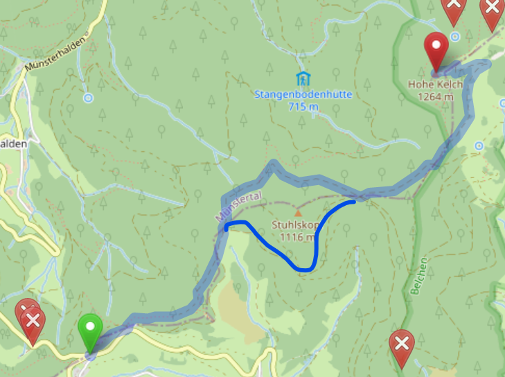
Haldenhof – Hohe Kelch (easy to fairly easy)

You can reach Haldenhof from Müllheim (Bus 111 Müllheim – Neuenweg Haldenhof until Neuenweg Haldenhof), from Basel (S6 to Schopfheim, then taking a bus 7310 Schopfheim, Busbahnhof – Neuenweg (Kr LÖ), Haldenhof until Neuenweg, Haldenhof). From then on it is a comfortable hike to Hohe Kelch.

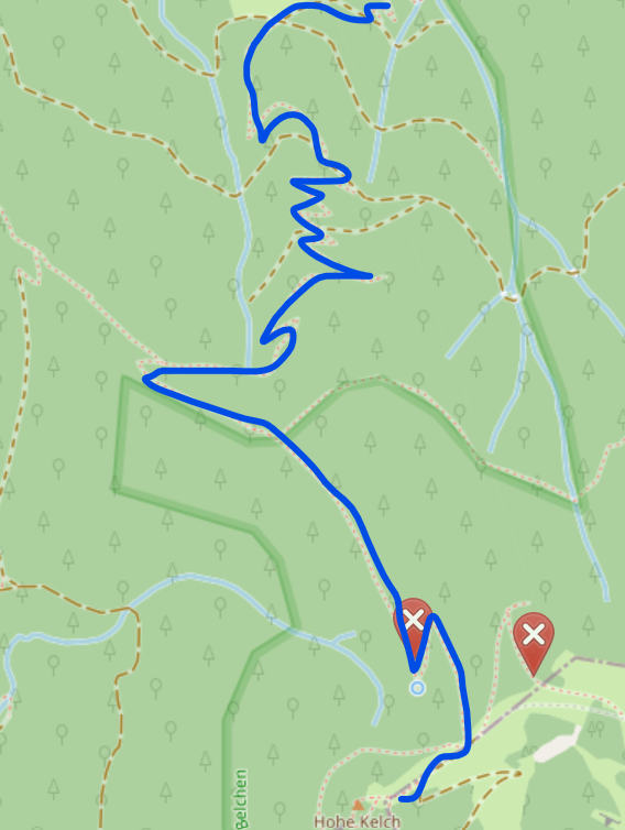
Route 4: easy + scenic 4,2km 1,5-2h hike. The pathway is very easy to follow, route is not steep at all with moderate ascent and only few steeper parts. Could be biked as well I assume (however never tried). In total around 450 high meters. It is usually the route of choice for us for a quick and painless walk to the Belchen :).

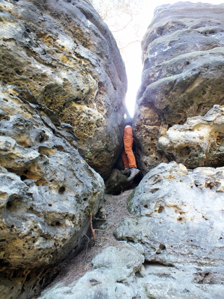
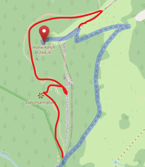
In case you would like a small challenge on this route, consider taking a d-tour (marked red) around the rocky part of the Hohe Kelch itself. It is a tiny bit longer and steeper, however it offers a fantastic view to Münstertal and Rhine valley. Highly recommended!

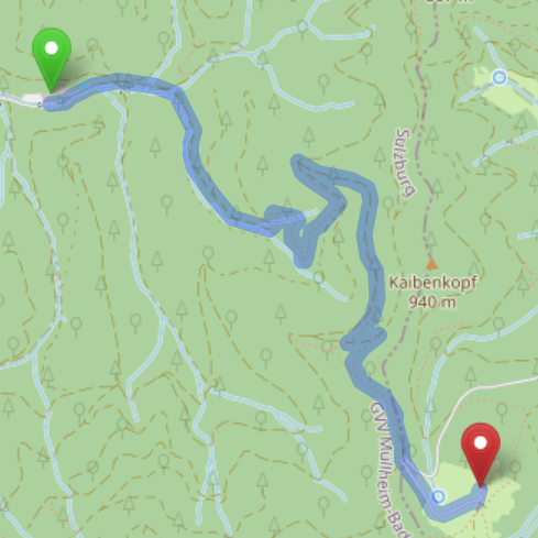
Sulzburg – Hohe Kelch (Moderate)

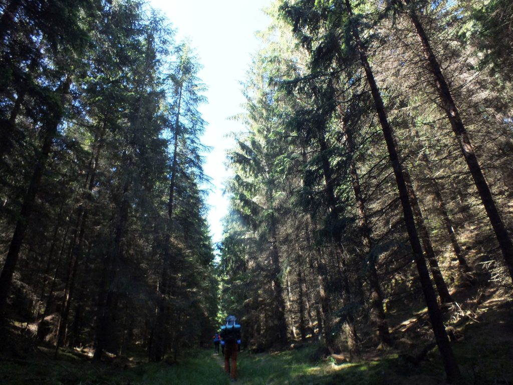
For those wishing for a longer hike following less known (but absolutely worth exploring) hiking ways in Schwarzwald, I could not recommend more this option. It is one of my all time favorite, even though it is relatively long.

You can get to Sulzburg by taking a bus 113 from Heitersheim train station, or biking from Heitersheim (roughly 6km). Biking has an advantage, as you can bike part of the hiking route and leave your bike at Waldhotel, saving yourself around 3km of a hike one way (downside being, that you should come the same way back to collect your bike).

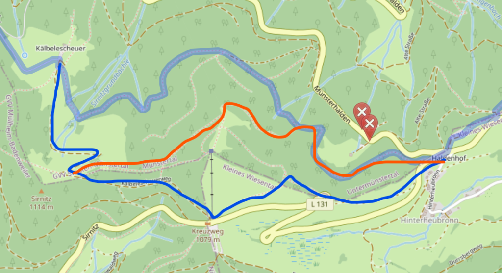
Route 5: moderate + very scenic 16km (13km from Waldhotel) 4-5,5h hike. The red circle is Waldhotel, orange circle is Kälbelescheuer (they serve food+drinks until 19:00). The route is leading until Haldenhof, then joins route 4 to the final leg.

The route until Kälbelescheuer is a bit more tricky to find, if you would consider this route, please do let me know, I will share a detailed map with you.

From Kälbelerscheuer I would follow to the Kreuzweg (more high meters, however very easy to follow) marked in blue and then to Haldenhof and Belchen or follow the ridge shortcut, marked in orange (not marked at all, might be harder to follow, slippy in wet conditions, would recommend only for experienced hikers).

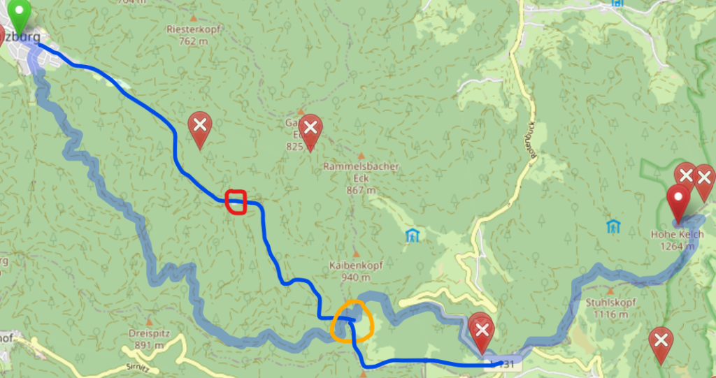
Münstertal – Hohe Kelch (Hard)

For those wishing for a real challenge, ascending from Münstertal direction will definitely offer it. While the distance is similar to route 5, westward face of Belchen is a quite steep climb. You can take a train from Bad Krotzingen toreach the end station in Münstertal, from there you can hike/bike to Mulden to start the route upwards. We usually go until Mulden by bike, and leave it at the end of the valley to spare ourselves a relatively boring walk Münstertal-Mulden.

Route 6: hard + very scenic ~8km (from Mulden), ~3h

The first leg of the hike is very idyllic, with rolling hills at the end of the valley, grazing fields and settlements. It is a fairly easy start, not so hard to follow.

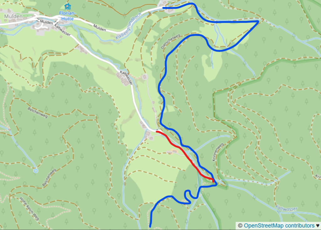
However, soon after the road will start to get steeper and more wigglier. There are several roads intersecting, however the route is relatively easy to follow. The final leg goes straight to Hohe Kelch.

In case you would like to prolong the hike and visit Belchen before reaching Hohe Kelch, you can make a d-tour, here marked in orange. Going to Belchen will add another 3-4km, high meters and another hour or so to the route.

There are many more routes available to reach Belchen/Hohe Kelch. Here are just a few that I have tried myself and thought are worth recommending. Feel free to explore the maps and the area to create the route best suited for your liking. The Belchen massive is indeed very scenic and I am sure everyone could find something fitting their fitness level.

Enjoy and do not hesitate asking question in case you would need help!

More information on some bus lines:https://rvl-online.de/liniennetz-fahrplan/linien/

Coming by car:

Coming by car makes things much more flexible and easier, you can modify the route depending on where you would chose to park. Generally every route mentioned above is available as well, however they might be adjusted depending on where you park.

For very easy routes, you might want to consider route 3, with least distance and high meters. Routes 1+2 also offer a fairly easy alternatives. For all 3 of the routes you should be able to park at Belchen Seilbahn Tahlstation.

There is a possibility to park at Haldenhof as well, however, there are very few parking spots and they all might be busy later in the morning. Parking at Kreuzweg is a great alternative. It adds additional ~1,5km to the route, but the extra distance rewards with fantastic scenery. From Haldenhof and Kreuzweg, you can embark on the route 4 (for extra piece from Kreuzweg, look at route 5).

Another great opportunity is to park at Kälbelescheuer, which is a restaurant and could offer an opportunity for a meal on your way home (it is open only until 20:00).

For routes 5 and 6, there are plentiful options for parking, both in villages or up in the valleys.

P. S. Most likely myself I will be taking route 4. Anyone wishing is welcome to join me on the hike itself :). Otherwise we see each other on Hohe Kelch!

P.P.S. Of course the invitation is extended to all of your family or whomever would like to join! Feel free to bring friendly doggos or other pets that might enjoy hiking (once we met a hiking donkey on Hohe Kelch!).

Germany. The wall tour

Once you come to Berlin you will be tempted by a number of historical and cultural sites for a visit and most of you most likely will be seduced by East Side gallery or Check Point Charlie. Berlin wall, that was perturbing the life of inhabitants, lasted for nearly 30 years and its caused division is still felt in nowadays city. It became not only the symbol of the region, but also the massive tourist attraction. But is one truly seeing and understanding the history of the wall by visiting only the famous touristic sites?

To approach the history of the wall in a different manner, the idea to bike its perimeter came. The total distance around the West sector would be 155km, which is way to ambitious for one day, therefore we decided to achieve only the city dividing part from north to south, which is about 60km long.

By quick internet search we have acquired the map of the route and also found the information, that the full length of the wall is transformed into marked bicycle route. The distance seemingly doable still required some planning and preparation – it goes through the most crowded neighborhoods in Berlin and therefore we expected to be delayed, yet still manage under 7 hours.

The start was planned at the northern boundaries of the city early in the morning. The wall tour starts close to Hohen Neuendorf, which is technically Berlin but still has a provincial feeling with cute old town and cobbled streets. The planned start was not so easy to find in the local forest park. Luckily there are signs guiding to the old watchtower that is left after the wall was destroyed. From the watchtower the brand new bicycle route Mauerweg follows the former wall throughout the city. At the North it is going through a wonderful forest, that I never thought to be located in Berlin. It was really surprising to see so much nature surrounding sleepy and cute neighborhoods. Even some farms and horse ranches were on the way, which made Berlin feel rather rural.

This kind of calm lifestyle was felt until Prenzlauer Berg. Here the Berlin wall tour turned into the famous and hip Mauerpark, surrounded by hipster cafes and groups of tourists. The bike road became noticeably more crowded but the tour offered many information stations for those curious about history. Our highlight was the observation of the remaining wall fragment. And I mean not only the one row of painted concrete blocks, but a real wall, in its all thickness, how it used to be back in days.

There is an observation tower (free of charge), where you could go quite comfortably to look at the wall structure from above. One could see how wide the wall actually was, that it had several ‘layers’ and well lit brushed sand, to see the footsteps of illegal crossing. The small museum is sharing the stories and history of the wall, illegal crossing from East to West. The wall now is turned into memorial park. It is not only a lovely place for a walk, but also is informative, as there are many of memorial boards, telling curious stories about the wall.

It is interesting to see, that along the former wall, a lot of new building have been built. After the unification of East and West Berlin, the territory of the wall (which actually is not too little) offered new territory for building, which is being happily used until today. The area close to Hauptbahnhof is being built completely new, which allows more living spaces in a cramped city that receives many newcomers every year.

Along the route one could find some wall leftovers and other relics. A surprise watch tower was spotted next to Spree, just before reaching the central station. Awkwardly sitting in the middle of the residential buildings it is easy to miss, unless you come from the right angle. There were no one to visit this curious kinda-like-a-monument of the wall and from this point, the closer one gets to the touristic hot-spot (Brandenburg gate), the more popular and crowded other wall leftovers are.

The deeper in the city we biked, the less tour signs there were. Sometimes arrows on the poles would disappear for several streets, sometimes it would become a darker stone line on the middle of the road. It became notably harder to find the exact position of the wall, which might be not a big problem for those, who just want casually drive through the divided territory (to be honest, does it really matter if we skip a street or two and then come back to track?). But we were determined to follow the exact division pattern, so several hours were lost due to double checking the wall location on internet and then trying to follow it though the crowded city.

The most crowded place on the trip was Check point Charlie, where tourists get scammed and most likely pick-pocketed. It used to be the border crossing point, controlled by Americans. There were 3 of them in total and this one was the only one at the center of the city. Now it is a place for tourists to take an overpriced picture with ‘American soldiers’ or go to an extremely crowded Mauermuseum.

Avoiding crowded central areas in Friedrichshein we crossed Spree and headed towards Kreuzberg, which is an excellent stop for lunch, by the way. Once out of the main streets there, we could once again enjoy empty streets. City started to become green and rural again following the Mauerweg South. It is in some way surprising, how much space Berlin actually has outside the hip central neighborhoods and how much more calm and green it is there. It sometimes does not look or feel like Berlin at all.

The Southern part of the route was extremely quick and easy, as the way is almost straight and well marked. At some point it becomes not so nice to follow, as there was a highway built ower the former wall. For some good 6 to 8 km I was following this highway on bike speed way. It was quick and not so bad, but definitely not very interesting. On the far horizon one could see grey Soviet blocks, that reminded me of home a little bit.

It was still Berlin and I could not believe my eyes – wast meadows, so much beautiful nature and space. Towards the Southern most point of the wall, which was also the finishing point of the day, bike way became less and less taken care of. At some point I was driving a narrow garden colony road, that was marked as a Berlin Wall tour. Unfortunately it finished with a dead end. I tried to go around but with no luck, the trip had to be finished there.

Two years later after this tour I still think, how impressive it is, that Berlin is stretching 60km from North to South. I would like to recommend this tour not only for history enthusiasts but also for anyone who has the time to see not only touristic, artistic and fun Berlin, but how it actually is in real life of real people. From fancy and spacious villas in the North to dodgy and low-income southern outskirts, from glamorous and freshly built Mitte to grey sadness of Soviet blocks. It is unforgettable and contrast rich one-day bike trip, that is worth making for those living in Berlin as well as you might find some spots you would have never found otherwise. And for the end my advice is: get lost, at least several times on the road. It gives extra adventurous flavor :).

Powered by Wikiloc

Germany. From Vils to Naab

When the summer days were still incredibly hot and long, we decided to roast ourselves a little bit more and see the south. There was no real plan included, no booked places or activities, just an Interrail ticket in our pockets and huge backpacks on our backs.

It was important that this year we kept our no flying streak, so we planned mainly to use local public transportation and hitchhiking. This way we wanted to explore more remote and unique areas, rather than moving from one tourist trap to another. To start the exploration from ‘our own backyard’, we decided to make Nürnberg our first stop. In middle ages city was a center of culture, trade and politics; today, even if the city was heavily bombed, it surprises the visitors by rich and beautiful massive old town, as well as old and impressive castle on the top of the hill.

Besides cute German style white houses with dark wood lines (the ones that Americans love) the other interesting attraction was the old fountain – Schöner Brunnen. Although it is not as hot of a tourist attraction as former Nazi sites and most of the people pass over it without a longer consideration, I found it to be a rather fascinating structure. This 14th century craftsmanship survived until today only because it was hidden during the WWII. It reflects not only the finery of the art and symbolism back then, but also the worldview of Roman Empire: it pictures not only religious figures but also prince-electors and philosophers. There are also several legends about the fountain.

Our quick tour was ended by climbing to the Nürnberg castle, which provided not only the view of the cities skyline, but also an informative museum about the regional history. Built in middle ages, this sturdy castle served as a seat of kings and Roman emperors until it lost its importance during the 30 years war. During the latest world war it was destroyed to ruins and restoration until the present state took over 40 years.

To be honest, we did not plan to stay long in the city and the road turn inwards Bavarian wilderness. The next day we got a canoe offer from our friends and there we were already floating on the Vils river.

The start was decided to be in Schmidmühlen, where Vils is still a small and not more than knee deep. It started with a little bit of fast water but nothing really dangerous. It seems to be the best start as upriver from this point is too dangerous for inexperienced paddlers (us), the water is narrow there and is surrounded by cliffs, coming close to each other.

The problem with this trip was that we had to figure out how to come back to the car, as it is a linear route. We decided to always have one person on bike following the canoe by car. It was a peaceful and sunny day, river followed the fields and hills of Bavaria. It was so unbelievably remote, as I imagined Bavaria to be very crowded. The right side of the flow was extremely empty, as I have learned later on, it is a military zone, and not a small one.

The interesting fact about the zone, that we have heard from local friends, is that there is another one about 40km North. Both of them are taking a massive land space for short distance missile shooting tests/practice and were established by American army after WW2, as they controlled this region after Germany’s surrender. Basically they sit and shoot at each other missiles during the broad day light. I thought it was very curious, as former US bases are being abandoned and dismantled across the country (some of them used for housing later on, as Germany has a massive living space shortage), but these two are actively operating. We even heard some shooting while kayaking next to it.

On the map, these two suspiciously uncharted regions are the US military bases. Vils river flows a great deal at the border of the zone, which gave its peace and worries. Belonging to military this land piece looked wild at the border, yet many signs informed that stepping there might be the last idea of your life (or at least a very bad one).

It was a nice and easy river, getting rapidly wider and deeper as it approached its joining to Naab. The route had its wild moments as well as some cute villages where we stopped for a break or boat transportation over the man-made obstacles. It was a relatively dry summer in Germany, so the water levels at some wider spots dropped drastically and several times we had to walk besides the kayak. Yet, once we saw a fallen tree over the water, blocking the way completely, we decided that this time we can jump over it and that it was enough water to not the stuck. We were also a little bit too lazy to carry the kayak around, but never mind. So we gained some speed and tried our best and of course it did not work. The boat got stock on the tree trunk (that would not have been a problem with higher water) at the first third of the boat.

And then the game started. Tried to move back. No luck. Tried to move forward. No luck. paddling was not strong enough. Pushing from the tree itself did not help. Jumping and leaping forwards as well. One could have went out of the canoe but it was pretty deep and the water was not clear – could have been dangerous branches or other sharp thing underneath. Everything we tried seemed to not work. The trunk we were stuck on was right under my butt, so I moved to the very front of the kayak, but this alone did not help. We both had to move to the very front. It was a challenge to relocate ourselves without ending up in the river and once we were there, we still had to ridiculously try to jump by jerking our weight forward.

The kayak started to move, yet it was very small distances. We had to continue it for at least 10 min until we were floating again. The worst part, that our friend saw everything from a bridge nearby, as we were planning to finish the last piece of the river all together.

We planned and finished our journey where Vils meets Naab – in Kallmünz. There we had some fast water and some paddling against the Naab, in order to safely land on the side, we wanted and needed. After securing the kayak on the car roof we went for a local sight-seeing. This tiny town hold a beautiful medieval old town and castle ruins. The hill did not look so big from the river, yet climbing it proved to be not so easy. The old-town was sitting on its side and the tiny pass-ways might not always lead where the castle is. The terrain is too steep for cars so it provided a calm stair climbing event until we reached the castle path.

Once atop the view is far and incredible. The beauty of the settlement and the fields around it, same as the rivers crossing the hilly terrain made a big impression on me. Kallmünz used to be an art colony, where a lot of artists would come to relax, practice and meet same minded and it was not without a reason – the scenery is indeed gorgeous.

The whole region is perfect for castle hoppers. It is possible to visit at least one a day without a bigger trouble. Before leaving to our another stop – Regensburg – we managed to quickly hike to the Wolfstein castle ruins next to the Neumarkt in der Oberpfalz. It was a beautiful spot to catch the last sun of the day and enjoy another beautiful view. We also learned the Celtic tribes had big settlement here and even flattened some hills for better protection and visibility.

A massive castle is now being slowly restored but the entrance remains open 24/7, which makes it a wonderful place for evening walks and night star gazing. As it is not on the main touristic route, you most likely will spare yourself the frustration of tourist masses, which is another reason to take your kayak and explore the unknown side of Bayern!

Powered by Wikiloc

Germany. Empire of Sandstone (pt. 2)

If you enjoyed the first part of the trip, this small story will introduce you to a less touristic Saxonian Swiss. Even if the park is heavily visited by tourists, it is still possible to avoid the crowds and have a calm hike in and around this beautiful sandstone temple.

After a heavenly sleep and a soup for breakfast we found out that we don’t really have a set plan for the day. The map we had with us suggested, that there is a boofen for a night sleep on the other side of the river – Zschirnstein, here we come!

The fun part was, that there is no straight forward road from our sleeping place. We slowly wiggled down the hills searching for a better road. Combined map and Open Street Maps strength showed us a pretty straight road crossing the cliffs. The group suspected, that this might be not very passable but yet we still decided to try, as the ‘real road was not really leading to the direction we preferred. After several unsuccessful turns we found a suspiciously straight road leading in between two ridges. Map promised a pass though the rocks that this road will bump into. As it looked good enough, we followed.

The road started to climb slightly upwards and rocks came closer and closer. As we reached Erreichtturm, we decided to climb it for a snack. The day was still young but the place looked just too good to miss the opportunity. Once we started to get closer, more people joined us, apparently this part is popular among rock climbers. It took us a while to find a road to the top, but oh boy, the view and the sun there was so rewarding!

As we ate and rested, more and more climbers came for a day here. We even saw some nice boofen for sleeping there but the signs warned, that camping here is not wanted.

The hour of truth came – will we be able to cross the cliffs or not. OSM showed a faint road between two rocks but the rigged environment did not help us to find it easier. We zigzagged by some raising crags and found the narrow crossing between two massive walls. Obviously this road is not very often hiked. But oh boy, how exciting it was: a massive and old beech tree met us once we were on top. So its leaves were to blame for covering the road for us.

The further road was extremely long and not so exciting. We got into one of the main ways to reach Scmilka as there was the ferry crossing Elbe. It went up and down, the backpacks started to weight more, feet got more tired, water ran dry. The last hundred meters were crucifying, as the road went steep down and big stones put there for the easier climb up were slippy and more disturbing than helpful. Tired and thirsty, but still rather early in the day we reached the village. It was packed with people but we still found a place at the spring to fill our bottles and wash our tired feet.

The other side progressed another not too short of a hike and it met us with a very short but extremely steel climb. We were already to done that we stopped talking and just slowly dragged ourselves up. I counted every step but lost the number after 500 stairs. The heat was not helping as well. Of course, our party had no real hats and once we reached the top, we had to cross open fields in the midday heat with the sun boiling our brains. Who took a scarf, who took a T-shirt but once something was on our heads, life became much better.

Reaching Schöna was hot and not fun at all, crossing it as well. Only fields and no shadow. When the forest was once more in the horizon we rushed there with the rest of our energy. Damn this road, there still was a distance to go until we could legally camp. We chose the quickest and the straightest way, put the rest of the will and hiked straight until it made us nauseous.

Finally the road turned and we were there! How happy we were but only until we realized that we still need to climb a little bit. The road was covered once more, yey. Second wave of tiredness reached us. One of us left the backpack and went for a scouting tour to find the road. Several minutes later we were happy once more after seeing our luxurious sleeping place. So much space, wonderful view and no one to share it with.

Next morning I kicked the boys out of sleeping bag at 4.30 in the morning – time to climb up and meet the sun. Grumpy and not so enthusiastic group packed the stuff, found the way up and was amazed by the sunrise. No one was there for kilometers. And if, most likely they were still sleeping and dreaming their 9th dream. It was absolutely worth every early minute of climb. Zschirnstein is one of the highest in the region and it opened the wonderful view over the Saxonian Swiss. Recommend it to anyone interested in panoramic views – it saved our not super nutritious or tasty breakfast.

We realized that we hiked through most of the park, we were tired and not very interested in further adventures anymore. After quick clean up we were rushing once more, this time for a train. The start was early and the train station was reached just before the lunch time. Counted the kilometers made – more than 60. Happy about the result we boarded the train and slept the tired sleep of our life.

Powered by Wikiloc